

Imagine spending weeks on a deal only to discover a hidden utility easement that renders the backyard unbuildable. It's a common nightmare for local real estate professionals who rely on fragmented, outdated data sources. Most people think a standard San Diego interactive property map is enough to clear a listing, but basic dots on a screen don't tell the whole story. You need a platform that connects the dots between recorded documents and physical boundaries. In a market where San Diego County taxable property values hit $845 billion in 2026, the cost of missing a single detail is simply too high.
We know how frustrating it is to jump between clunky government GIS portals and confusing land use codes while your clients wait for answers. You deserve a streamlined way to visualize risk and opportunity without the technical headache. This guide shows you how to master the complex landscape of San Diego property data using advanced overlays and professional intelligence tools. We'll explore how to generate instant AI summaries of recorded documents, create professional PDF reports for your clients, and use unified map views to spot hidden easements. By the end, you'll have a clear roadmap for turning raw data into actionable real estate intelligence.
Key Takeaways
- Differentiate between static parcel views and dynamic intelligence tools to avoid working with fragmented or outdated information.
- Identify hidden utility easements, flood zones, and pipeline overlays instantly to protect your clients from unforeseen property encumbrances.
- Discover why a professional San Diego interactive property map offers a competitive edge over technical GIS websites by providing interpreted, user-friendly data.
- Master a streamlined risk analysis process to generate professional PDF reports and AI-powered summaries of complex recorded documents.
Navigating the San Diego Property Mapping Landscape
In 2026, property research has evolved far beyond checking a simple parcel line. A modern San Diego interactive property map acts as a real-time intelligence hub. It should provide instant access to more than just boundaries; it needs to reveal the story behind the dirt. With San Diego County taxable property values reaching $845 billion this year, the stakes for accuracy have never been higher. Professionals now demand dynamic tools that overlay zoning, topography, and Assessor Parcel Numbers (APN) into a single, cohesive view.
The difference between a static map and a dynamic intelligence tool is the ability to interpret data. Static maps tell you where a property is. Dynamic tools tell you what you can do with it. As the City Council approved 134 amendments to the Land Development Code in May 2026, keeping up with these changes manually is nearly impossible. Curated platforms do the heavy lifting by integrating these complex updates directly into the map interface.
The Evolution of San Diego GIS
The region's data foundation rests on massive public databases maintained by regional authorities. While a Geographic Information System (GIS) is an incredible feat of engineering, these raw databases aren't designed for the speed of a real estate transaction. They're built for urban planners and civil engineers who have the training to navigate layers of raw technical data. For a realtor, raw data can be misleading because it lacks the context of recent recorded documents or specific encumbrances.
The industry is shifting toward user-friendly interfaces that prioritize clarity over complexity. Modern property intelligence tools strip away the technical friction. They present high-level data in a way that allows you to make decisions in seconds rather than hours. This evolution empowers agents to act as their own data analysts without needing specialized training or an engineering background.
Why "Official" Maps Often Fall Short for Realtors
Government portals offer a wealth of information, but they often force users into a fragmented experience. You might find zoning on one map, flood hazards on another, and historic designations on a third. This "Information Gap" creates a significant risk for professionals. Relying on free government portals often results in a hidden time-cost that kills productivity. Consider these common friction points:
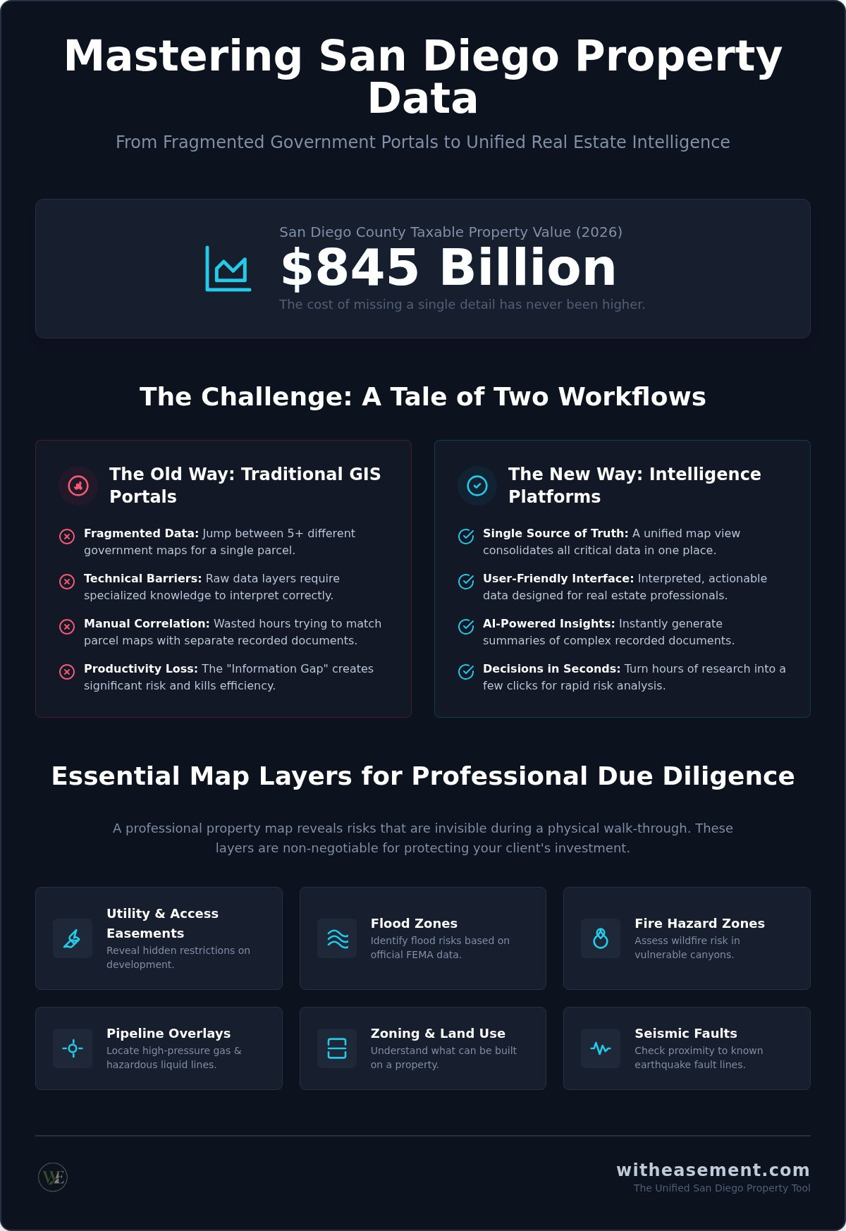
- Data Fragmentation: Jumping between five or more different map viewers to see the full picture of a single parcel.
- Technical Barriers: Navigating complex layers that require specialized knowledge to interpret correctly.
- Manual Correlation: Trying to match a raw parcel map with a separate list of recorded easements or HOA boundaries.
Efficiency is the new standard. Real estate professionals are moving away from raw government data in favor of unified platforms that provide a "single source of truth" for every parcel in the county. By using a San Diego interactive property map designed for professionals, you eliminate the guesswork and focus on closing deals.
Essential Map Layers for Professional Due Diligence
Professional due diligence requires more than a visual scan of a neighborhood. A high-performance San Diego interactive property map layers technical data over geographical reality to reveal risks that aren't visible during a walk-through. This unified view is the only way to ensure you're seeing the full picture of a parcel. Effective environmental and real estate due diligence involves checking for flood zones, fire hazards, and seismic faults. In San Diego, where the landscape shifts from coastal bluffs to fire-prone canyons, these layers are non-negotiable for protecting your client's investment.
Pipeline overlays and gas line locations provide an additional safety layer that most free maps ignore. Knowing the proximity of high-pressure lines or hazardous liquid pipelines is vital for both residential safety and commercial development. You can unlock these critical layers instantly with a WithEasement membership, which consolidates fragmented data into a single, professional interface.
Easement and Pipeline Overlays
Recorded easements can significantly impact property value and future development potential. Utility, access, and sewer lines often sit on private land with strict usage restrictions that prevent building pools, ADUs, or extensions. Standard plat maps frequently miss these "hidden" lines, leading to costly surprises during construction or escrow. Identifying these encumbrances early in the process prevents deals from falling through at the last minute. For a deeper look at identifying these specific encumbrances, consult our San Diego property easement search guide.
HOA and Community Data
In 2026, knowing exactly where Homeowners Association (HOA) jurisdictions begin and end is essential for accurate property marketing. Buyers need to understand association rules, monthly fees, and community restrictions before they sign a contract. An interactive map that visualizes these boundaries saves hours of manual research by showing you exactly which association governs a specific street or block. Review our San Diego HOA documents guide to understand how association data impacts your deal and how to interpret the underlying documents.
By integrating these layers, you move from simple map viewing to true property intelligence. This proactive approach ensures that every deal you handle is backed by the most comprehensive data available in the San Diego market.
Official San Diego GIS vs. Professional Intelligence Tools
Choosing between a public portal and a professional intelligence tool isn't just about price; it's about the quality of your workflow. Public GIS systems serve as incredible data repositories, but they're built for urban planners rather than real estate agents. When you use a professional dashboard, you're not just looking at a San Diego interactive property map; you're accessing a curated environment designed for speed and clarity. This shift from raw data to interpreted intelligence defines a modern real estate practice in 2026.
Raw parcel data often leaves you with more questions than answers. You might find a recorded document number but then spend twenty minutes trying to download and read the fine print. Professional tools solve this with AI Summaries that interpret complex recorded documents instantly. Instead of messy browser print-outs that look unprofessional to clients, you can generate branded PDF Property Reports that present technical findings in a clear format. These reports transform technical jargon into a value-add for your buyers and sellers.
The Limits of Free Government Portals
Public access portals often rely on third-party vendors for property characteristics. These services typically impose strict search caps, sometimes limiting users to just 25 searches per month. For a busy listing agent, these limits are hit within the first few days of work. These systems also suffer from siloed data. You'll find yourself jumping between federal maps for flood risks and local planning portals for zoning updates. Most of these government sites lack a mobile-responsive design, making it nearly impossible to conduct reliable research while standing on a driveway during a showing.
The Membership Advantage for Real Estate Pros
A WithEasement Membership removes these barriers by offering unlimited property lookups by address or APN. You get a unified view where Flood Zone and Pipeline Overlays sit directly on top of property boundaries. This consolidation reduces research time from hours to minutes. Consider the efficiency gains of seeing every encumbrance on one screen:
- Unified Data: View easements, flood zones, and HOA boundaries simultaneously.
- AI-Powered Insights: Skip the manual review of deeds with instant summaries of recorded documents.
- Unlimited Access: Conduct as many searches as your business requires without hitting vendor caps.
In a market with over one million taxable parcels, having the right San Diego interactive property map isn't a luxury; it's a competitive necessity. It allows you to provide immediate, accurate answers that free portals simply can't match.
How to Conduct a Property Risk Analysis with Interactive Maps
Performing a comprehensive risk analysis requires a methodical approach that goes beyond a simple search. A professional San Diego interactive property map allows you to move through a standardized workflow that identifies red flags before they become deal-breakers. By following a structured process, you ensure that no hidden encumbrance or environmental hazard is overlooked during the due diligence period.
Follow these five steps to complete a professional-grade property assessment:
- Step 1: Locate the property using the specific Address or Assessor Parcel Number (APN) for maximum accuracy.
- Step 2: Layer the Property Easement Search and pipeline overlays to check for underground encumbrances.
- Step 3: Toggle environmental hazard layers to assess flood zones and fire risk.
- Step 4: Verify the HOA status and community boundaries to confirm association jurisdiction.
- Step 5: Generate a professional PDF Property Report to present these findings to your client clearly.
APN Lookup: The Key to Accurate Records
Searching by address alone is a common trap for real estate professionals. Addresses can be duplicated across the county or changed in new developments, but the APN remains the definitive identifier for land records. Using the APN ensures you're looking at the correct parcel boundaries on your San Diego interactive property map. This is especially critical in older neighborhoods where lot splits or historical easements might not align with current street addresses. Common mistakes in San Diego parcel identification often stem from relying on third-party marketing sites that don't sync with the Assessor's latest data roll.
Interpreting Environmental Hazard Layers
Environmental layers provide the data you need to justify offer prices or anticipate insurance costs. In San Diego, understanding FEMA flood zone designations like Zone AE or Zone X is vital for determining if a buyer will face mandatory flood insurance premiums. Beyond water, you must identify geologic hazards. Mapping the Rose Canyon Fault or other seismic zones is a standard part of professional risk analysis. These overlays allow you to visualize how a property's location relative to a canyon or a known fault line affects its long-term value and safety.
Moving through this workflow manually takes hours of clicking through different tabs and government sites. You can streamline this entire process and access unified data layers by choosing a WithEasement Membership to power your property research.
WithEasement: The Unified San Diego Property Tool
WithEasement transforms raw data into a competitive advantage. While other platforms offer generic statewide information, this tool focuses exclusively on the unique complexities of the local market. It serves as a unified San Diego interactive property map that brings together every layer discussed in this guide. By consolidating Flood Zone and Pipeline Overlays with association boundaries and recorded documents, it removes the friction from your daily workflow. You don't need to maintain multiple logins or guess at the accuracy of free government portals anymore.
Local specialization matters because San Diego land use is distinct. From the 2026 updates to the Land Development Code to the specific nuances of Rose Canyon fault lines, having a tool tuned to local records is essential. WithEasement acts as your digital partner. It performs the heavy lifting of data organization so you can focus on client relationships and closing deals. It's the bridge between dense public records and the actionable insights you need to win in a fast-paced market.
AI-Powered Property Summaries
Reviewing recorded documents is often the most time-consuming part of due diligence. Legal descriptions and easement language are notoriously dense and difficult to parse quickly. Our AI Summaries solve this by interpreting the legal jargon for you. The system scans recorded documents to extract the most relevant details about utility access, setback requirements, or usage restrictions. This ensures you never miss a critical detail hidden in the fine print. Realtors and investors save hours of manual review while gaining the confidence that their analysis is backed by high-tech precision. You're getting the "cliff notes" of the most complex land records in seconds.
Professional Reporting for Clients
Transparency is the foundation of trust in real estate. When you present a listing or advise a buyer, having professional documentation sets you apart as a local expert. The WithEasement platform includes a powerful generator for PDF Property Reports. These reports are designed for listing presentations and buyer consultations. They offer a clean, branded summary of all property intelligence. They include visual map overlays and interpreted data that make complex risks easy for clients to understand. You can join WithEasement to unlock professional tools and start delivering these high-value insights today.
In a landscape with over one million taxable parcels, speed and accuracy are your most valuable assets. By using a specialized San Diego interactive property map, you ensure every decision you make is informed by the most comprehensive intelligence available.
Master Your Property Intelligence Strategy
Mastering the complex landscape of local real estate requires more than just access to data. It requires a tool that interprets that data for you. By moving beyond fragmented government portals, you gain a clearer view of property risks and opportunities. A professional San Diego interactive property map isn't just a convenience; it's a strategic asset that allows you to spot hidden easements and hazards in seconds. You've seen how the right intelligence can prevent deal-killing surprises and save hours of manual research.
You now have the roadmap to conduct faster due diligence and build stronger client trust. WithEasement streamlines this process by providing unified San Diego County data layers and AI-powered property summaries that decode dense legal language instantly. You can transform these technical insights into professional PDF reports for realtors with a single click. This level of clarity empowers you to lead the market and close deals with total confidence. Start your comprehensive San Diego property search today with WithEasement and unlock the intelligence you need to stay ahead.
Frequently Asked Questions
How do I find an interactive parcel map for San Diego County?
You can access official data through various public portals or use a professional platform like WithEasement for a more streamlined experience. A San Diego interactive property map designed for real estate allows you to enter an address or APN to see precise boundaries instantly. These tools consolidate various data layers into one view, making it easy to identify parcel characteristics without navigating multiple technical sites.
What is the best tool for checking property easements in San Diego?
A professional Property Easement Search is the most reliable method for identifying utility, access, and sewer lines. While standard plat maps often lack detail, intelligence platforms overlay recorded documents directly onto the map. This helps you spot encumbrances that could restrict building or impact property value. It's a vital step for any listing agent or developer conducting due diligence.
Can I see HOA boundaries on a San Diego property map?
Yes, you can visualize association jurisdictions by using HOA Searches with boundary overlays. This feature shows you exactly where specific community rules and fees apply for any given parcel. It eliminates the need to cross-reference fragmented databases. You'll know instantly if a property falls under a homeowners association, saving you time and preventing communication errors with your clients.
How do I look up property flood zones in San Diego?
Access flood data by toggling Flood Zone and Pipeline Overlays on your interactive map. These layers use current FEMA designations to highlight specific risks. Identifying these hazards early helps you anticipate mandatory insurance costs and advise buyers on potential safety concerns. It's an essential part of a modern risk analysis workflow for local properties.
Is there a free interactive map for San Diego zoning?
The City of San Diego offers public zoning maps through their official gallery, which includes community planning and council district layers. However, these free tools are often siloed and technical. Professional platforms integrate these zoning details with other risk factors like easements and flood zones. This provides a unified view of development potential and land use regulations without jumping between different browser tabs.
How can I get an AI summary of San Diego property records?
You can generate AI Summaries of complex land records through the WithEasement platform. The system scans dense legal language in recorded documents and extracts the most relevant details about usage restrictions or utility access. This saves you from hours of manual document review. It ensures you don't miss critical information hidden in the fine print of a deed or easement.
What is the difference between public GIS and professional intelligence tools?
Public GIS portals are technical data repositories used primarily by engineers and planners for raw land base data. WithEasement is a professional intelligence tool built specifically for the real estate industry. It takes raw San Diego data and adds interpreted features like AI-powered summaries and hazard overlays. You can also generate downloadable PDF Property Reports that are ready to present to your buyers or sellers.
Can I search for San Diego properties by APN on a map?
Searching by Assessor Parcel Number (APN) is the most accurate way to locate a parcel on a San Diego interactive property map. Addresses can be inconsistent in new developments, but the APN is a unique identifier that links directly to the tax roll. Professional tools allow you to enter this number to instantly highlight boundaries and access all recorded documents associated with that specific piece of land.


